Log in
All resources
Create a design
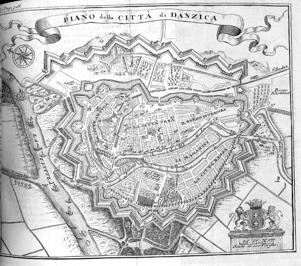
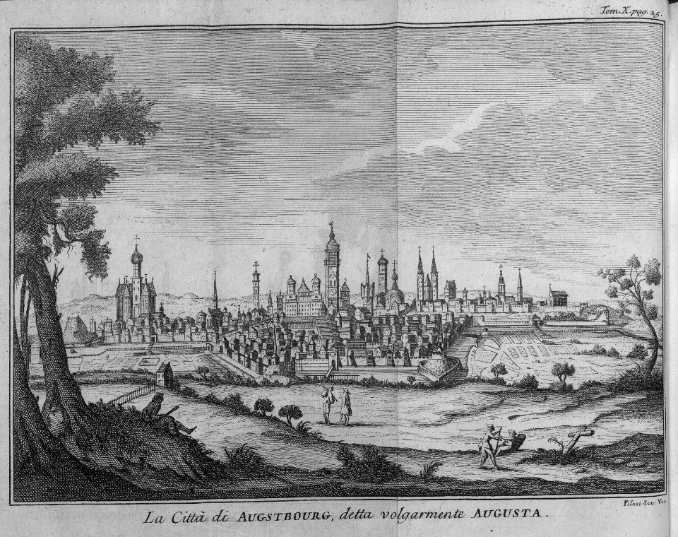
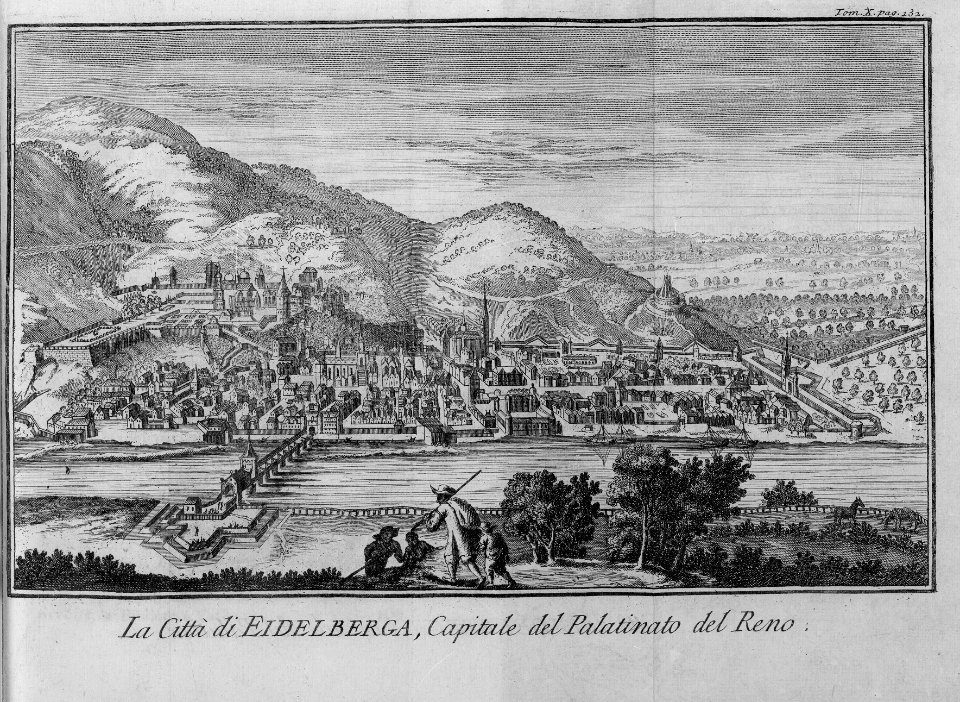
235 Free Artworks of 1740 Maps
bibliothèque nationale de france
maps in the rijksmuseum amsterdam
a description of the east, and some other countries (1743) knapton
internet archive document gri 33125009339611
cartography
engraving
chalcography
grabados
fondo antiguo
calcografía
old county maps of hertfordshire
maps by thomas kitchin
map of ancient armenia by philippe de la rué
maps of antony's parthian war
jean-fréderic phélypeaux
guillaume dheulland
jean-fréderic phélypeaux
guillaume dheulland
chorographia britanniae (1741-1742)
1740s maps of wales
chorographia britanniae (1741-1742)
1740s maps of wales
plants
maps
maps of paris by john rocque
1740s maps of paris
maps of paris by john rocque
1740s maps of paris
maps of paris by john rocque
1740s maps of paris
maps published by hendrik de leth
algiers in the 18th century
cartography
maps
cartography
maps
1740s maps of the world
maps by emanuel bowen
1740s maps of bavaria
johannes condet
maps in the rijksmuseum amsterdam
johannes ratelband
a description of the east, and some other countries (1743) knapton
old maps of turkey
topographia helvetiae, rhaetiae et valesiae (1654) engravings
baroque
eran laor cartographic collection
gerard valck
a description of the east, and some other countries (1743) knapton
rococo
a description of the east, and some other countries (1743) knapton
18th-century maps of the aegean sea
navigantium atque itinerantium bibliotheca
1744 fleurons
maps by isaak tirion
1740s maps of japan
theatrum historium ad annum christi quadringentesinum by guillaume delisle (1705)
1740s maps showing history
satirical prints in the british museum
realism
satirical prints in the british museum
realism
maps in the rijksmuseum amsterdam
old maps of india
a description of the east, and some other countries (1743) knapton
cartouche (cartography)
a description of the east, and some other countries (1743) knapton
18th-century maps of the sea of marmara
carte des côtes de malabar et de coromandel (1723)
philippe buache
1740s maps of the americas
1747 maps of north america
prints, drawings and watercolours of the royal museums greenwich
william henry toms
maps in the rijksmuseum amsterdam
caspar specht
prints by claes jansz. visscher (ii) in the rijksmuseum amsterdam
siege of schenkenschans 1636
maps in the rijksmuseum amsterdam
hendrik de leth
201 - 235 of 235
/ 3


![A Map of South Wales: West from London / T. Badeslade delin[eavit]; W.H. Toms Sculp[sit], 1741](https://cdn.creazilla.com/illustrations/10000319175/a-map-of-south-wales-west-from-london-t-badeslade-delineavit-wh-toms-sculpsit-1741-sm.webp)
![A Map of North Wales: N. West from London / T. Badeslade delin[eavit]; W.H. Toms Sculp[sit], 1741](https://cdn.creazilla.com/illustrations/10001551176/a-map-of-north-wales-n-west-from-london-t-badeslade-delineavit-wh-toms-sculpsit-1741-sm.webp)